
History
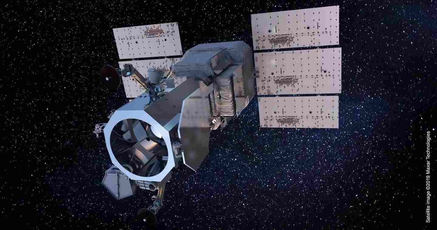
WorldView-3 is a commercial Earth-observation satellite developed for DigitalGlobe, which later became part of Maxar Technologies. It collects high-resolution optical and shortwave-infrared imagery for mapping, environmental monitoring, resource analysis, disaster assessment, and other remote-sensing applications.
The spacecraft was launched on 13 August 2014 aboard a United Launch Alliance Atlas V 401 rocket from Vandenberg Air Force Base in California. It entered a sun-synchronous orbit at an altitude of approximately 617 km.
WorldView-3 introduced a commercial imaging system combining a high-resolution panchromatic channel, eight visible and near-infrared bands, eight shortwave-infrared bands, and 12 atmospheric-monitoring bands. The European Space Agency describes it as the first commercial satellite sensor to combine multiple payloads with super-spectral, high-resolution imaging.
WorldView-3 joined DigitalGlobe satellites including Ikonos, QuickBird, WorldView-1, GeoEye-1, and WorldView-2. It was positioned in a lower orbit than WorldView-2, improving its ground sampling distance while retaining a similar mission concept.
Published summaries differ on the spacecraft's manufacturing attribution. The USGS characterization report describes WorldView-3 as designed and built by Lockheed Martin using the BCP-5000 bus, while another compiled specification identifies Ball Aerospace as the manufacturer. Both sources associate the satellite with the BCP-5000 spacecraft platform.
Design
Spacecraft and orbit
WorldView-3 uses the BCP-5000 satellite bus and had a launch mass of approximately 2,800 kg. Its reported electrical power is 3,100 W. The spacecraft operates in a near-polar sun-synchronous orbit, allowing it to observe locations under broadly consistent lighting conditions.
The orbital altitude is approximately 617 km, and the orbital period is about 97 minutes. The descending-node equator crossing occurs at approximately 10:30 local solar time. The ESA mission profile reports a one-day revisit time at 1 m ground sampling distance and 4.5 days at 20 degrees off-nadir with a ground sampling distance of 0.59 m.
WorldView-110 imaging system
The primary WorldView-110 camera collects panchromatic imagery at a nadir ground sampling distance of 0.31 m. Its eight visible and near-infrared bands provide a nadir ground sampling distance of 1.24 m. These bands cover coastal blue, blue, green, yellow, red, red edge, near-infrared 1, and near-infrared 2 wavelengths.
The panchromatic channel covers wavelengths from 450 to 800 nm. The visible and near-infrared channels extend from 400 to 1,040 nm. The added coastal blue, yellow, red-edge, and second near-infrared bands support more detailed classification of land and aquatic features than conventional four-band imagery.
Shortwave-infrared sensor
Eight shortwave-infrared bands cover selected wavelengths from 1,195 to 2,365 nm and provide a nadir ground sampling distance of 3.7 m. Shortwave-infrared data can reveal spectral differences that are difficult to distinguish in visible imagery and can support geological mapping, mineral analysis, vegetation assessment, and observation through some smoke and atmospheric haze.
CAVIS sensor
The Clouds, Aerosols, Vapors, Ice, and Snow sensor, known as CAVIS, contains 12 bands with a ground sampling distance of 30 m. It measures atmospheric and surface conditions that can affect image quality, including clouds, aerosols, water vapor, cirrus, and snow.
CAVIS data supports atmospheric correction of imagery from the main camera. Processing algorithms can use this information to filter and color-correct images affected by atmospheric conditions.
Collection capacity
WorldView-3 can collect imagery covering up to 680,000 km² per day. Its reported imaging swath is 13.1 km. The combination of high spatial resolution, multiple spectral regions, and atmospheric measurements enables the production of detailed mosaics and analytically corrected image products.
Operational history
WorldView-3 entered orbit successfully on 13 August 2014 and remains listed as operational by ESA. Its imagery has been used for environmental monitoring, agriculture, forestry, infrastructure analysis, geological mapping, coastal studies, disaster assessment, and high-resolution change detection.
Researchers have used WorldView-3 data to identify and monitor methane emissions from offshore oil and gas facilities. Its imagery has also supported studies of deforestation, wildfires, and other environmental changes.
In 2015, an international archaeological team used near-infrared imagery from WorldView-3 while investigating a possible Viking settlement at Point Rosee in Newfoundland. The location was initially presented as a potential second Viking settlement in North America, although the identification remained a research interpretation rather than a confirmed satellite discovery.
From 2020, researchers also used high-resolution satellite imagery and machine-learning methods to detect and count African elephants without requiring observers to be present on the ground. On 7 October 2022, WorldView-3 captured an image of the Landsat 8 satellite while both spacecraft were in orbit.
Operators
- DigitalGlobe: Original commercial mission operator at the time of launch in 2014.
- Maxar Technologies: Operated WorldView-3 following the incorporation of DigitalGlobe into Maxar's Earth-imagery business.
- Vantor: Listed as the satellite's owner and operator in later mission records.
Specifications (WorldView-3)
General characteristics
- Type: Commercial Earth-observation satellite
- Spacecraft bus: BCP-5000
- Launch mass: 2,800 kg (6,200 lb)
- Electrical power: 3,100 W
- Launch date: 13 August 2014
- Launch vehicle: Atlas V 401, mission AV-047
- Launch site: Vandenberg Space Launch Complex 3 East, California
- COSPAR identifier: 2014-048A
- Satellite catalog number: 40115
Orbit
- Orbit type: Sun-synchronous
- Orbit altitude: Approximately 617 km (383 mi)
- Orbital period: Approximately 97 minutes
- Inclination: 97.97 degrees
- Equator crossing: 10:30 local solar time, descending node
- Revisit time: One day at 1 m ground sampling distance; 4.5 days at 20 degrees off-nadir and 0.59 m ground sampling distance
Imaging system
- Total spectral bands: 29
- Panchromatic bands: One, covering 450–800 nm
- Panchromatic ground sampling distance: 0.31 m at nadir; 0.34 m at 20 degrees off-nadir
- Visible and near-infrared bands: Eight, covering selected wavelengths from 400 to 1,040 nm
- Visible and near-infrared ground sampling distance: 1.24 m at nadir; 1.38 m at 20 degrees off-nadir
- Shortwave-infrared bands: Eight, covering selected wavelengths from 1,195 to 2,365 nm
- Shortwave-infrared ground sampling distance: 3.7 m at nadir; 4.1 m at 20 degrees off-nadir
- CAVIS bands: 12
- CAVIS ground sampling distance: 30 m
- Imaging swath: 13.1 km (8.1 mi)
- Maximum daily collection: Up to 680,000 km²
Related equipment
- WorldView-2: Earlier WorldView commercial imaging satellite with a similar mission architecture.
- WorldView-4: Subsequent high-resolution satellite in the WorldView series.
- GeoEye-1: High-resolution commercial Earth-observation satellite operated within the same wider imaging fleet.
 Argentina
 Armenia
 Australia
 Austria
 Austria-Hungary
 Belgium
 Brazil
 United Kingdom
 Brunei
 Bulgaria
 Canada
 Chile
Chile China
China Colonial America
 Colombia
 Confederate States
 Croatia
 Czech
Czech Denmark
 Egypt
Egypt Finland
 France
 Georgia
 Germany
 German Imperial
 Greece
 Holland
 Hungary
 India
India Indonesia
 Iran
Iran Iraq
Iraq Ireland
 Israel
 Italy
Italy Japan
Japan Japan (1940)
 Jordan
 Kingdom of Italy
 Malaysia
 Mexico
 Myanmar
 Nazi Germany
 Netherlands
 New Zealand
 North Korea
 Norway
 Pakistan
 Peru
Peru Philippines
 Poland
 Portugal
 Prussia
 Romania
 Russia
 Saudi Arabia
 Serbia
 Singapore
 Slovakia
 Slovenia
 South Africa
 South Korea
 Soviet Union
 Spain
Spain Sweden
 Switzerland
 Syria
Syria Taiwan
 Thailand
 Turkey
 UAE
UAE Ukraine
 Vietnam
 Yugoslavia